
The Maleny Community Precinct Obi Obi Parklands concept plan is presented here along with a series of informative maps. The maps in many instances aim to support the written information available on other pages of this website.
Click on a map to open a full screen version.
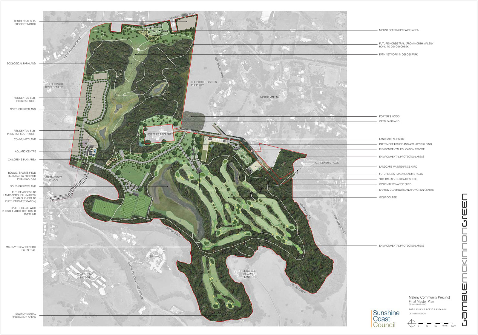 |
Maleny Community Precinct Final Master Plan Map
This map produced by Sunshine Coast Regional Council in June 2010 shows the approved final master plan for the Maleny Community Precinct. Many of the ideas and design elements from the Obi Obi Parklands team have been incorporated into the final design. |
|
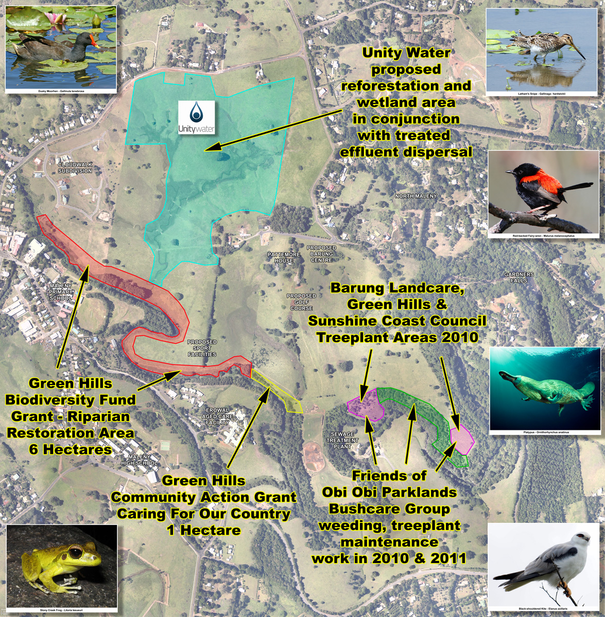 |
Maleny Community Precinct Reforestation Map This map shows an overview of the restoration works planned for the next three years on the precinct, covering much of the riparian area.
|
|
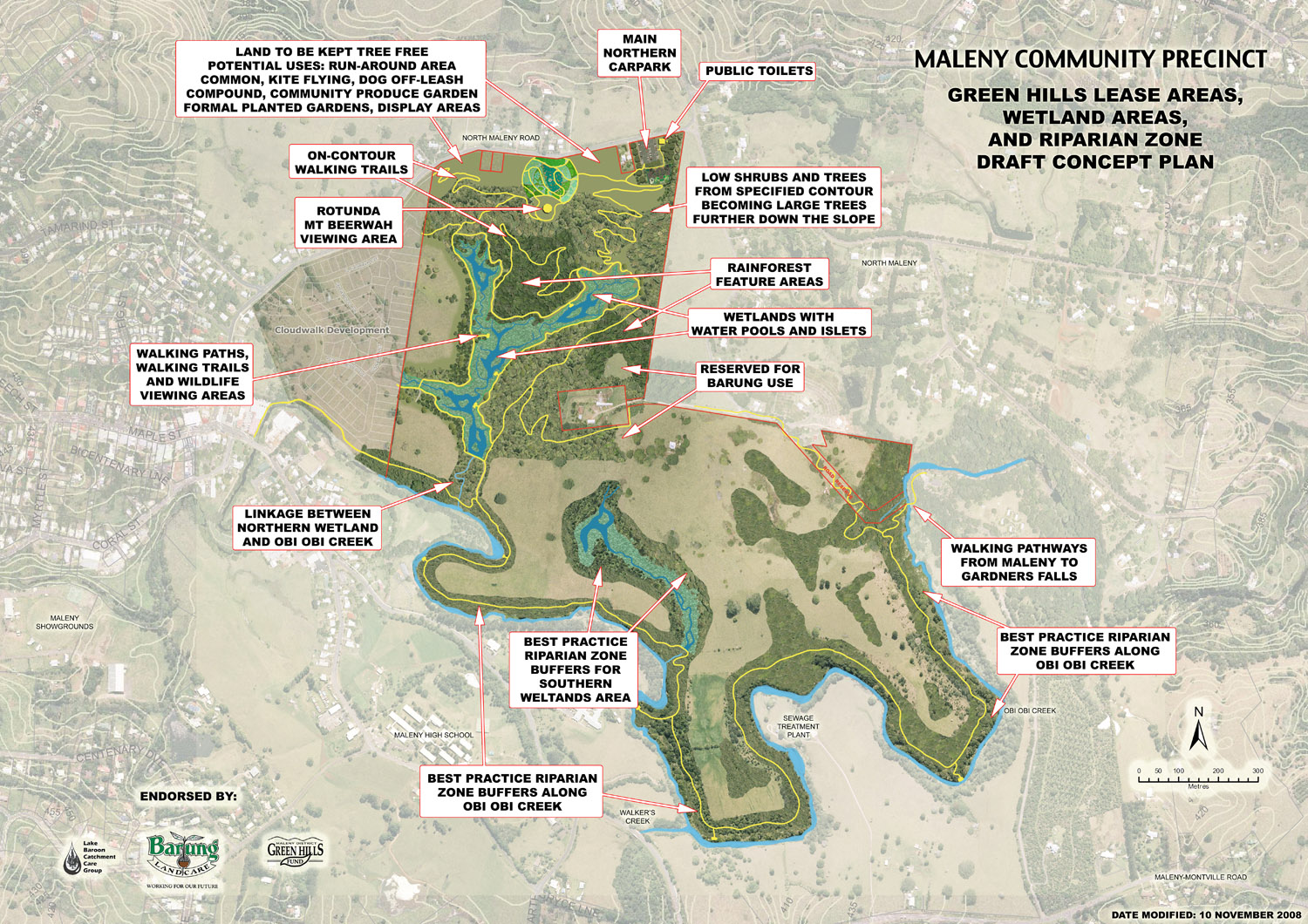 |
Obi Obi Parklands Concept Descriptive Map
This map shows all the key elements of the concept plan as presented to Council in December 2008. Green Hills worked closely with Sunshine Coast Regional Council to ensure that the Obi Obi Parklands concepts were incorporated into the overall master plan for the precinct. |
|
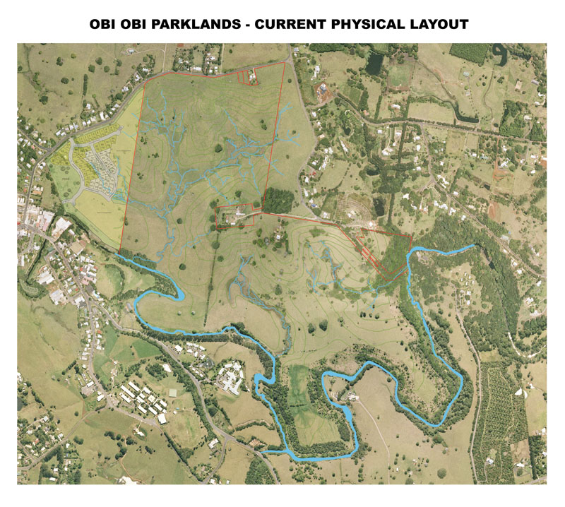 |
Existing Layout - Maleny Community Precinct
An aerial photograph with existing drainage lines and Obi Obi creek clearly delineated. The existing property boundary is also shown. |
|
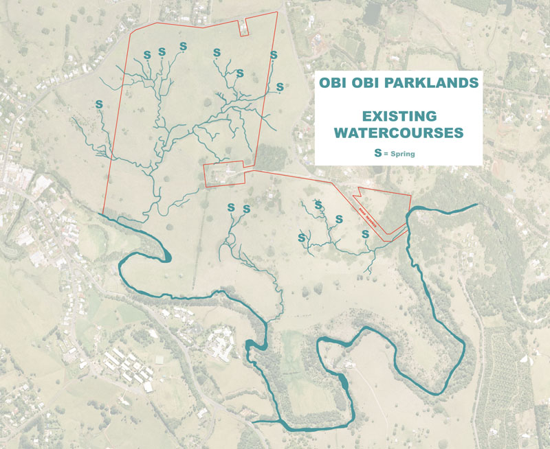 |
Existing Watercourses
This map details the existing drainage lines and springs to be found on the property. Obi Obi Creek high bank is clearly delineated. |
|
 |
Wetland Areas
The site contains two distinct wetland areas. The larger north west wetland could form a major feature in Obi Obi Parklands. |
|
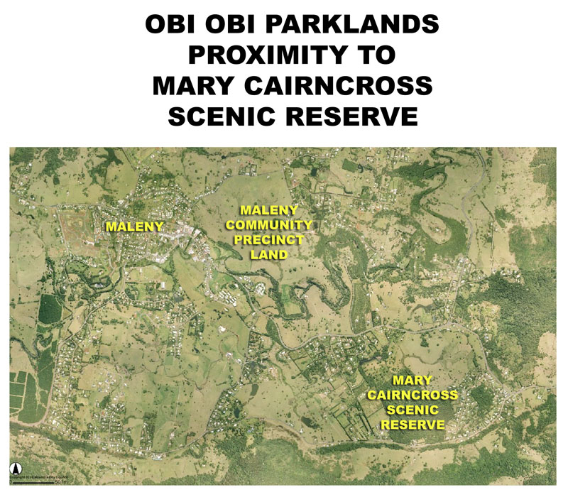 |
Mary Cairncross Proximity Map
This map shows the relationship between the largest remnant rainforest in our region and Obi Obi Parklands - an area which would rival Mary Cairncross Scenic Reserve in time. |
|
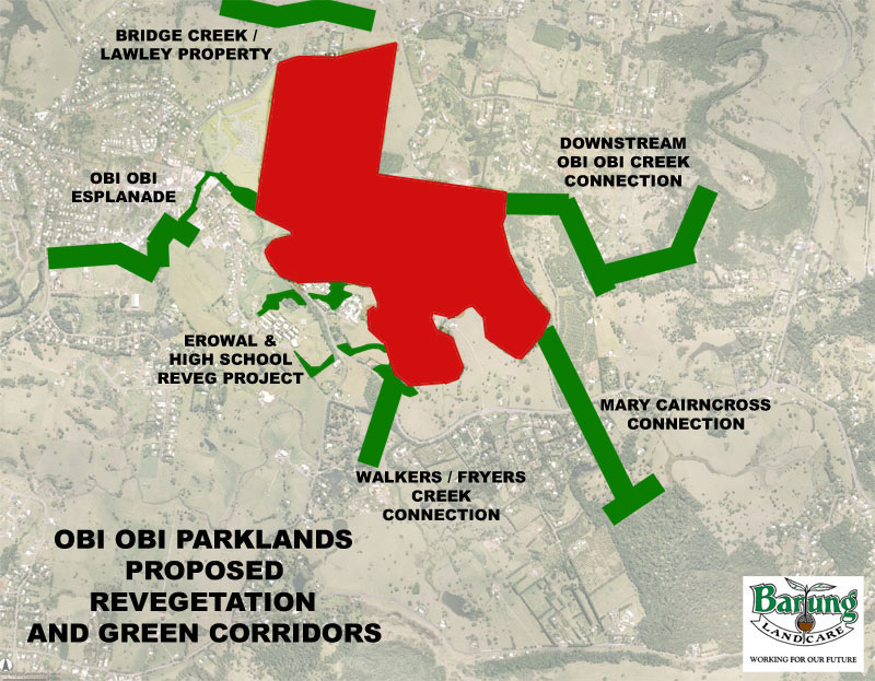 |
Proposed Revegetation Areas and Green Corridors
This map details the importance of this site as a central link in the efforts of Barung Landcare to restore wildlife corridors in our area. |